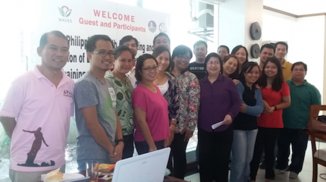
Training on GIS and SedNet in Southern Palawan

Philippine Wealth Accounting and Valuation of Ecosystem Services
April 20 – 24, 2015
Ipil Suites, Puerto Princesa, Palawan
ACTIVITY DESIGN
Activity: Training on GIS and SedNet for estimating sediment discharges and scenario building selected watershed of Southern Palawan
Objectives:
1. Train Phil-WAVES TWG members of Southern Palawan in basic GIS operations and sedimentation discharges modeling,
2. To generate sediment budgets of priority watershed of Southern Palawan, and
3. To generate scenarios showing sedimentation changes relative to land cover change.
The expected outputs of the training are:
1. Developed a pool in the Phil-WAVES TWG and other stakeholders who are trained in GIS operations to estimate sediment discharges of watershed;
2. Estimated sediment discharges of Pulot watershed based on current setting;
3. Developed sets of scenarios of sediment discharges from selected watershed;
4. Estimate physical ecosystem service (sediment retention) of the Pulot watershed;
5. Group reports of participants on estimation of stream discharges; and
6. Suggestions/Recommendations for improving the training module.
Training Method:
The training consists of two parts: (1) training on the basics of GIS operations including GIS data processing; (2) training on the use of SedNet to estimate sediment discharge from watersheds. After brief theoretical lecture on GIS and SedNet, the participants will have a hands-on experience of GIS using Quantum or available GIS software and SedNet. Participants will be provided existing data on Pulot Watershed in Southern Palawan. The training is designed so that the learning from the hands-on can be applied in modeling other watersheds. The final output of the training is an estimate of the sediment retention services (ecosystem regulation service) of the watershed. Participants will be required to submit outputs at the end of each daily session.
For shared learning purposes, participants with limited background on GIS will be grouped or will partner with a GIS-experienced participant. However, individual assigned tasked will be submitted by each participant. Participants will also have individual work time to practice unassisted in generating data and conducting GIS analysis. A report will be submitted by each participant at the end of the day. Assessment of the results will be handed by the trainers at the start of each day.
The trainers will demonstrate the various GIS operations and will spend time to mentor participants on the data processing, analysis and reporting. The trainers are:
1. Mr. Arnan B. Araza – GIS-Specialist
2. Verna D. Lacanlale – Environmental Systems Specialist
3. Gem B. Castillo – Resource Economist
The trainers will provide PowerPoint materials that include steps in data processing and GIS-analysis.
Selected participants from Phil-WAVES stakeholders are included as in the training for future upscaling purposes.
*Click on underlined titles to see presentations for those sessions that had them.
Program of Activities:
|
Time |
Activity |
Brief Description of Activity |
Person in charge |
|
Day 1: April 21 |
|||
|
8:00 – 10:00 AM |
PRELIMINARIES: |
||
|
|
Registration |
· Details and emails of participants |
Zeny and group
|
|
|
Software installation
|
· Inventory of programs available · Checking of software compatibility · Installation of software required |
Arnan and Verna
|
|
|
Welcome and Opening Remarks
|
· Welcoming of participants · Setting of goals and expectations |
DENR or PCSD |
|
|
Teaming-up and group tasking: |
· Teaming-up of participants · Group tasking Expectation Setting · Picture taking |
Gem/Arnan/Verna |
|
10:00-11:00 AM |
PRESENTATION: |
||
|
|
-history -relevance -components and applications -types and formats (raster and vector) |
· Basics of GIS and its operation · Individual evaluation and training |
Arnan and Verna |
|
10:45 – 11:00 AM |
B-R-E-A-K |
||
|
11:00 – 12:00 NN |
HANDS-ON TRAINING |
||
|
|
Software Interface
|
Training on basic tools and operations in ArcGIS |
Arnan |
|
12:00 – 1:30 PM |
L-U-N-C-H B-R-E-A-K |
||
|
1:30 - 5PM |
HANDS-ON |
|
|
|
|
-clipping/masking -intersecting and buffering |
Processing of input data (SedNet) using ArcGIS |
Arnan/Verna/Gem
|
|
3:00-3:15 |
B-R-E-A-K |
||
|
3:15 – 4:50 |
Attribute table operation -data manipulations -calculations -import/export |
· Processing of input data (SedNet) using ArcGIS |
Arnan/Verna/Gem
|
|
4:50 PM |
S-U-B-M-I-S-S-I-O-N- -O-F-- O-U-T-P-U-T-S |
||
|
Day 2: April 22 |
|||
|
9-10AM |
PRESENTATION: |
|
|
|
|
Recap and assessment of outputs of each team |
Verna and Arnan |
|
|
|
Step by step guide in running sedimentation analysis in SedNet |
· History · software description Components · Applications · types and formats (ASCII) · tools, commands and operations · base scenario · scenario editing · GIS post-processing |
Verna
|
|
|
Relevance to Phil-WAVES
|
· Presentation of results based from interim report · Example of ES in terms of avoided erosion |
Verna |
|
10:45 – 11:00 |
B-R-E-A-K |
||
|
11:00 – 12:00 NN |
PRESENTATION |
|
|
|
|
Dataset descriptions *emphasis on relevance and data sources |
· Presentation of the physical, climatic and hydrological data
|
Verna and Arnan |
|
12:00 – 1:30 PM |
L-U-N-C-H B-R-E-A-K |
||
|
1:00 – 3:15 PM |
HANDS-ON |
|
|
|
|
Dataset preparations using GIS operations (vector data manipulation, processing, rasterization and raster calculations) |
· Filled DEM · Soil Loss (RKLS)
|
Arnan/Verna/Gem
|
|
3:00 – 3:15 |
B-R-E-A-K |
||
|
3:15 – 4:50 |
HANDS-ON
Continuation of dataset preparations using GIS operations |
· Land-use · Riparian Vegetation
|
Arnan/Verna/Gem
|
|
4:50 PM |
S-U-B-M-I-S-S-I-O-N- -O-F-- O-U-T-P-U-T-S |
||
|
DAY 3: April 23 |
|||
|
9:00 – 10:00 AM |
PRESENTATION |
|
|
|
|
Verna and Arnan |
||
|
10:00 – 10:45 |
HANDS-ON |
|
|
|
|
Continuation of dataset preparations using GIS operations |
· Riparian Vegetation · Gully Density
|
Arnan |
|
10:45 – 11:00 |
B-R-E-A-K |
||
|
11:00 – 12:00 |
HANDS-ON
Continuation of dataset preparations using GIS operations |
· Mean annual rainfall · PET-Rainfall Ratio |
Arnan/Verna/Gem
|
|
12:00- 1:30 PM |
L-U-N-C-H B-R-E-A-K |
||
|
1:30 – 3:00 PM |
Continuation of dataset preparations using GIS operations |
· Hydrology (daily rainfall data processing) · Daily discharges and discharge points (streamflow/discharge modelling) |
Arnan/Verna/Gem
|
|
3:00 – 3:15 PM |
B-R-E-A-K |
||
|
3:15 -4:50 PM |
Continuation of dataset preparations using GIS operations |
· Hydrology (daily rainfall data processing) · Daily discharges and discharge points (streamflow/discharge modelling) |
Arnan/Verna/Gem
|
|
4:50 – 5:00 PM |
S-U-B-M-I-S-S-I-O-N- -O-F-- O-U-T-P-U-T-S |
||
|
DAY 4: April 24 |
|
|
|
|
9:00 – 10:00 AM |
PRESENTATION |
|
|
|
|
Recap and assessment of outputs of each team |
Verna |
|
|
10:00 – 10:45 AM |
|
· Base scenario · summary budgets · sediment sources per sub-catchment |
Verna |
|
10:45 – 11:00 AM |
B-R-E-A-K |
||
|
11:00 – 12:00 NN |
Running SedNet software
|
· Scenario analysis · summary budgets · sediment sources per sub-catchment
|
Verna |
|
12:00 – 1:30 PM |
L-U-N-C-H B-R-E-A-K |
||
|
1:30 – 3:00 PM |
Map Layout
|
· post-processing of SedNet outputs using GIS · Layout map of training output/
|
Verna and Arnan |
|
|
Geo-Tagging |
· Geo-tagged pictures within area of interests (e.g. hotspots) |
Arnan |
|
3:00 – 3:15 PM |
B-R-E-A-K |
||
|
3:15 – 4:30 PM |
Estimation of ecosystem services: biophysical accounts (Maps and Tables) |
Participants |
|
|
4:30 – 5:00 PM |
Individual Evaluation |
Verna/Arnan assisted by Phil-WAVES PMO |
|
